There are many interesting places on the South Coast Lighthouse Trail, apart from the three lighthouses, the area is rich in history, nature, and wildlife.
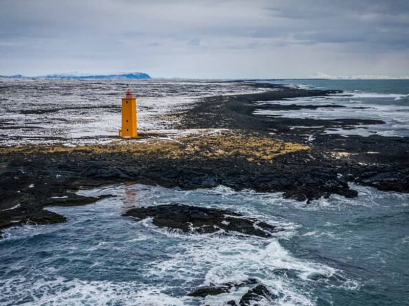
Selvogsviti Lighthouse
Selvogsviti was built in 1919 and rebuilt in 1931. The light height is 20 meters above sea level. In 1919, a 15-meter high iron frame was built on Selvogstangi. It was fitted with a 3.3 meter high light and a 200 ° dioptric 1000 mm lens and gaslight fixture.
The lighthouse was the same type as the Stokksnes lighthouse, built-in 1922. After only ten years, the lighthouse had become so rusty that it became necessary to build a new lighthouse, and in 1930 a 15.8 m high lighthouse was made of concrete. A year later, the lighthouse, lens, and gaslight fixtures of the iron frame lighthouse were installed on it, and the new Selvog lighthouse was taken into use. In 1987, the walls of the lighthouse were renovated. The lighthouse was electrified a year later, and a radar detector was installed on it. The light is now lit on the lighthouse for safety reasons, but the radio transmitters on top of it are the most important thing now.
The lighthouse is still in operation and is fully automated today.
Selvogsviti lighthouse is part of the beautiful South Coast Lighthouse trail that you can find more information about here.
View
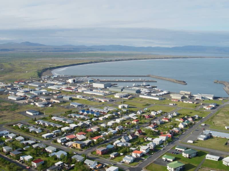
ÞORLÁKSHÖFN
The main town in Ölfus is Þorlákshöfn, west of Eyrarbakki. The town is important as a port because the only viable harbour on Iceland's southern coast between Grindavík in the west and Höfn in the east is situated there. The town has a population of about 1500 people.
The industrial foundations in Þorlákshöfn are ship-outfitting and fish processing factories, with business and service industries growing fast. Leisure opportunities for tourists are excellent, with an outdoor swimming pool with hot baths, a steam bath and a brand new waterslide. A good campsite is next door to the pool, with indoor cooking facilities and spaces for mobile homes. From the swimming pool you can select many walking routes in the surrounding area and longer walks along the coast, leading all the way to Selvogur and Herdísarvík, and along the beach leading to Óseyrarbrú and Eyrarbakki. In the Egilsbúð library and museum items that tell the story of the development of the town are to be found.
The town church in Þorlákshöfn is built in a unique style, and Strandarkirkja church in Engilsvík in Selvogur is famous as a place for vows. Anyone wishing to go caving has the Raufarhólshellir caves, which are some 1360 metres long. Duggan in Thorlákshöfn and Skíðaskálinn in Hveradalir offer many services to travellers, among them food and drink. Many scenes in the epic blockbuster movie "Flags of our Fathers" (directed by Clint Eastwood and produced by Steven Spielberg - 2005) were filmed on the black beaches close to Þorlákshöfn. There are also plans to construct a big international golf course close to Þorlákshöfn.
View
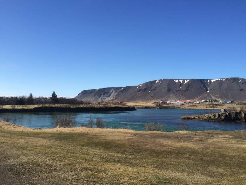
Ölfusá river
Ölfusá river is the most voluminous in Iceland, with an average flow of 423 m³/sec.
Three large floods occurred in the 20th century, and beside the restaurant, Tryggvaskáli, are lines showing each flood's height. All the floods happened during the wintertime due to heavy rains and high temperatures, which caused the snow to melt unusually fast.
Ölfusá River is relatively short, about 25 km (14 miles) long. About 6 km (4 mi) north of Selfoss are two rivers, Sogið and Hvítá, and combined form Ölfusá.
View
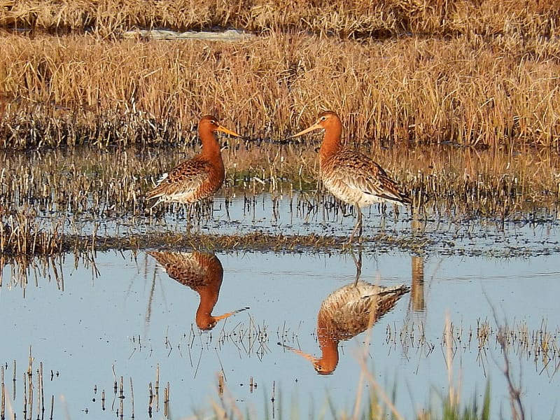
The Flói Bird Reserve
Northwest to the town of Eyrarbakki is a wetland area, rich in birdlife. The reserve has walking paths and a bird hide, an ideal spot for bird watching. The Flói Bird Reserve is listed in the Bird Life international Association. The Reserve is characterized by its flood meadows and numerous small ponds. Approximately 70 species of birds have been recorded in the Reserve. During spring and autumn migration Greylag Geese and White-fronted Geese can be found as well as Wigeon and Tufted Duck and various waders such as Snipe and passerines like Wheatear. During winter, birds, chiefly gulls and sometimes Long-tailed Duck and Common Eider, are concentrated in the estuary of the river Ölfusá. Whooper Swan, Teal, Mallard and Goosander are attracted to open water in winter.
View
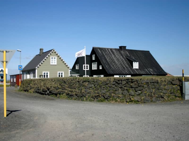
EYRARBAKKI
Eyrarbakki, pop. 585 is a friendly village that used to be the largest commercial community and main harbor on the South Coast of Iceland. Many preserved houses from 1890 to 1920 are situated in Eyrarbakki, and a visit is, therefore, like going 100 years back in time. Other great attractions are The Eyrarbakki Maritime Museum and the Árnessýsla Folk Museum, which is located in a building constructed in 1765, famously known as “The House”. Here you can also find a campsite, hostel, guesthouses and a great restaurant. On the rocky shoreline is a fantastic view of the Atlantic Ocean, where you can watch the surf break. It is an ideal spot for hiking and bird watching. Passing the beautiful recreational forest Hallskot northwest of Eyrarbakki, you enter the Flói Bird Reserve. It is a significant nesting area, especially for wetland birds, and is listed as an Important Bird Area (IBA) by BirdLife International.
ÁRBORG
The Municipality of Árborg was established in 1998. It consists of the town Selfoss, the villages of Eyrarbakki, Stokkseyri, and the Sandvík area. This region offers excellent options for recreation and relaxation, including a wide selection of restaurants, cafés, art galleries, museums, swimming pools, and a 9-hole golf course in Selfoss. A perfect location for any visitor who wants to stay closer to nature and explore unique landscapes such as large lava fields and black sand beaches.
View
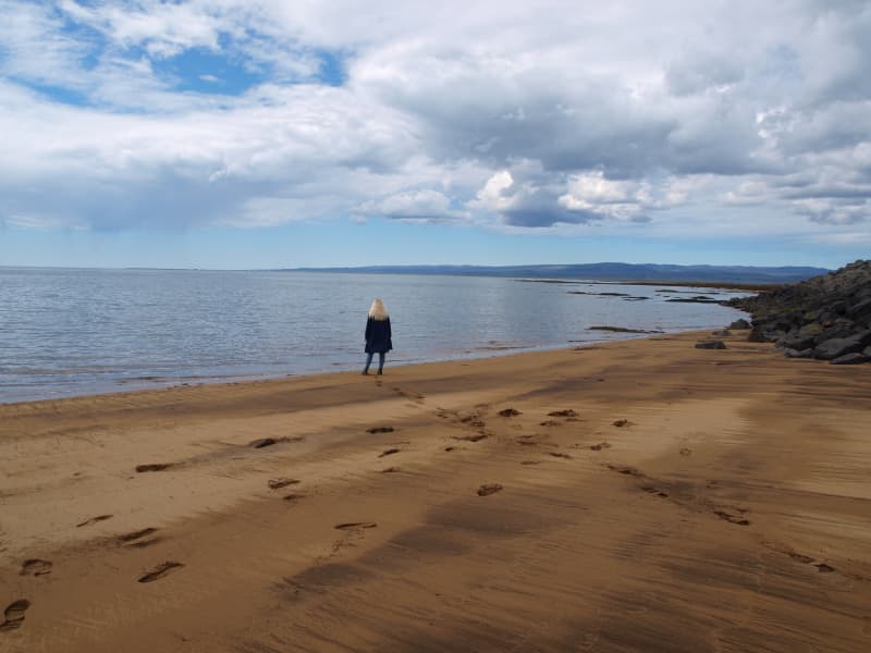
The coastline between Stokkseyri and Eyrarbakki
The coastline between the rivers Þjórsá and Ölfusá (25 km/15 mi) forms the outskirt of the great Þjórsárhraun lava field. Eyrarbakki and Stokkseyri provide easy access to the coastline as well as a path between the two villages where you can see the Atlantic Ocean and marvel at the fact the South Pole is directly to the south. This spot has a great view of both the ocean and mountains. Information signs can be found in both villages as well as an observation platform in Stokkseyri.
View
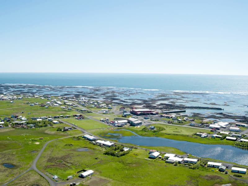
STOKKSEYRI
STOKKSEYRIStokkseyri, pop. 559 is a charming village renowned for its beautiful seashore, breaking ocean waves and birdlife, and rich in handicrafts and culture. Workshops, galleries, Ghost Center, and the Elves and Northern Lights Museum are all located in a Cultural Centre, Menningarverstöðin, an old fish processing factory that has found a new role due to changes in the fishing industry. The Wildlife Museum is dedicated to hunting and wildlife and contains many mammals and birds. The bunkhouse Þuríðarbúð provides an excellent example of how fishermen had to make use of what nature provided. Stokkseyri also offers one of Iceland's most famous seafood restaurants, an outdoor swimming pool, kayak tours, and a campsite. East of Stokkseyri is Knarrarósviti Lighthouse, built-in 1938 and put into operation a year later. For further information, visit the tourist information at the local Café, Gimli Kaffihús.
ÁRBORGThe Municipality of Árborg was established in 1998. It consists of the town Selfoss, the villages of Eyrarbakki, Stokkseyri, and the Sandvík area. This region offers excellent options for recreation and relaxation, including a wide selection of restaurants, cafés, art galleries, museums, swimming pools, and a 9-hole golf course in Selfoss. A perfect location for any visitor who wants to stay closer to nature and explore unique landscapes such as large lava fields and black sand beaches.
View
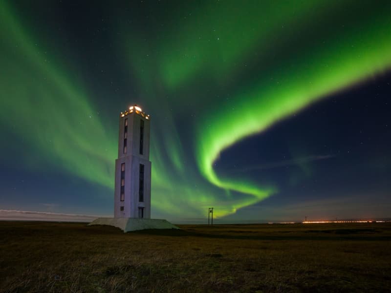
Knarrarósviti Lighthouse
Built-in 1938-1939, the lighthouse was the first one in Iceland to be built out of reinforced concrete. For a long time, the lighthouse was the tallest building in South Iceland, 26,2 meters (86 feet) high. It was designed by the engineer Axel Sveinsson as a blend of functionalism and art nouveau (jugendstil). In summertime (mid of June to start August) the lighthouse is open every day.
Knarrarósviti lighthouse is part of the beautiful South Coast Lighthouse trail that you can find more information about here.
View
Baugstadir Creamery
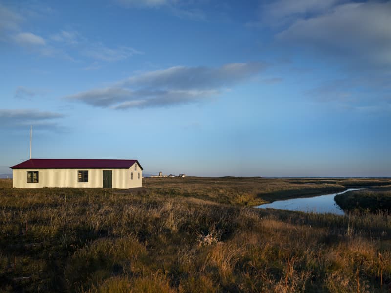
The creamery was established by local farmers in 1905 and operated until 1952. Its products were butter and cheese. The Baugsstaðir creamery was powered by a water wheel and is the only one of Iceland’s creameries that still retains its original equipment. A little to the west are the ruins of the creamery’s storage, which was an icehouse and used to store products before they were transported to market. The creamery’s main markets were in England as well as in Iceland.
View
